Things to Do | Visit Chiba | Latest update:2025/12/22
The coastal views and historic sites at Mt. Nokogiri (also called Nokogiriyama) make it one of the most beloved sightseeing spots in Chiba Prefecture. With a quick ride on the “ropeway” cable car, visitors can access the hiking trails found on the grounds of Nihon-ji Temple, and along these trails is where you’ll find the mountain’s famed vistas and Buddhist monuments. However, for those travelers who enjoy the journey as much as the destination, Mt. Nokogiri’s slopes are also home to a network of hiking trails starting from the mountain’s base. Just minutes from Hamakanaya Station on the JR Uchibo Line, or the Tokyo Bay Ferry terminal, you can start a hike to the top that’s fun for just about any skill level. The easy access and stunning sights make Mt. Nokogiri a great day-trip idea for those coming from not only within Chiba Prefecture, but also the greater Tokyo area. We created this guide so you can smoothly make your way up and back down the mountain with plenty of time to catch that evening train back home.
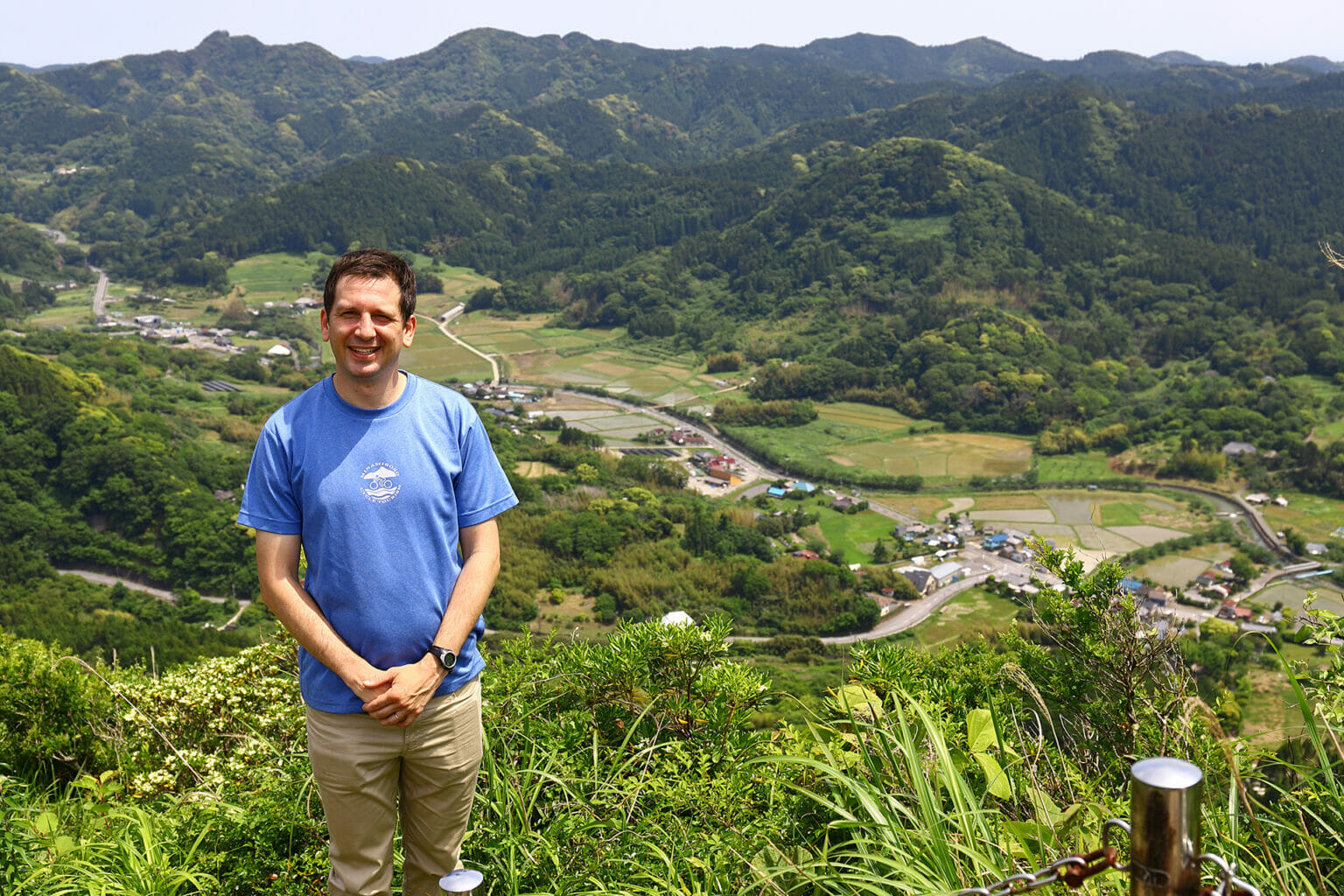
Whether you come by train or ferry, you’ll start your journey in the charming port town of Kanaya. If you’d like to explore more of the area, support local establishments, or even stay the night, please check the link below for our Kanaya recommendations.
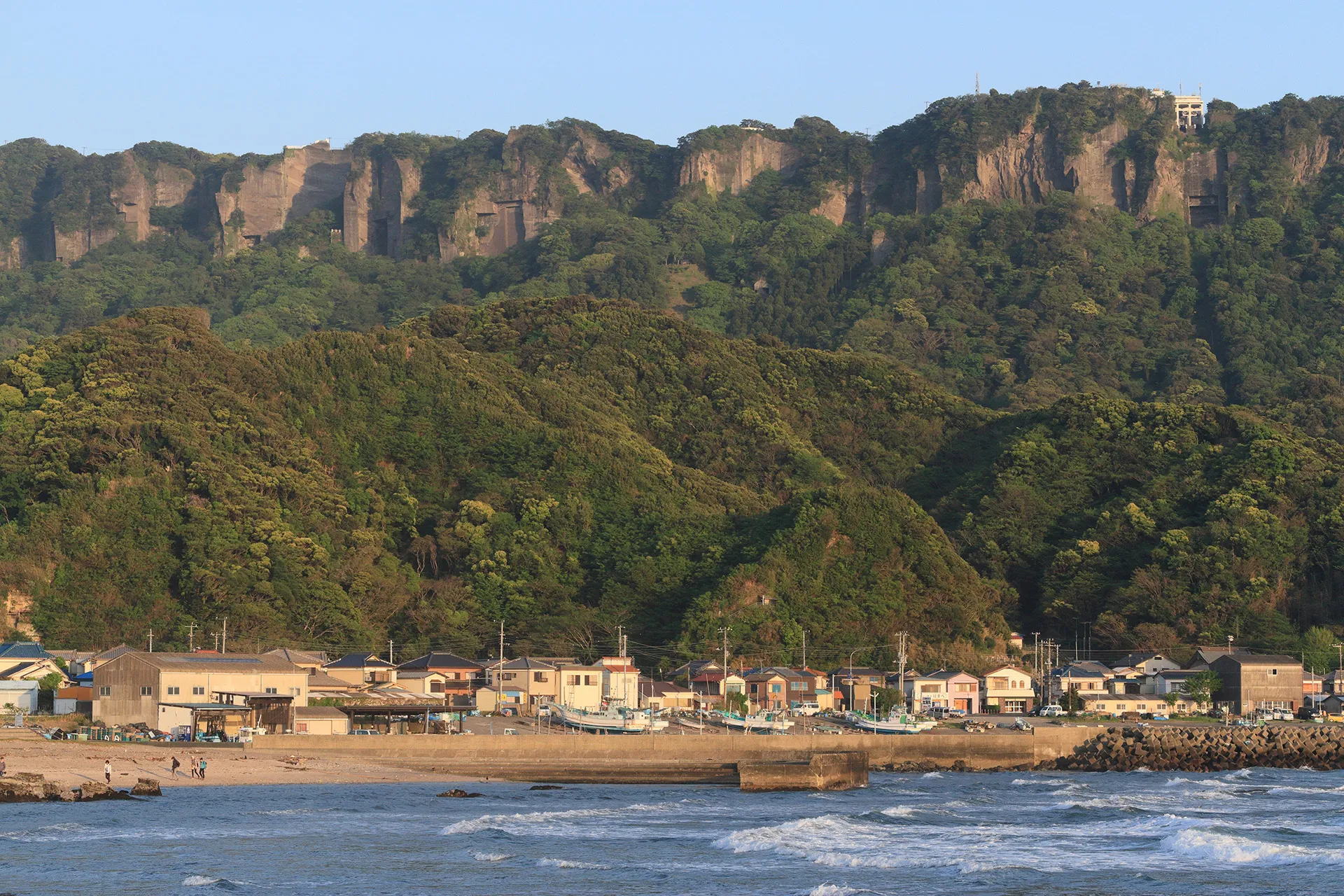
Mt. Nokogiri is called Nokogiriyama in Japanese, meaning “saw mountain,” due to its sawtooth-shaped profile. The mountain was used as a stone quarry starting during Japan’s Edo period (1603-1867), and the sharp cuts into the cliff faces over hundreds of years have further accentuated its jagged ridges, and in some cases left behind sheer vertical cliffs. Even before you start your hike, you can admire these unique bluffs both from afar and near the base of the mountain. One advantage to hiking all the way up the mountain, as opposed to taking the cable car, is that it gives you access to the sections of trails where you can get up-close views of these dramatic cliff sides.
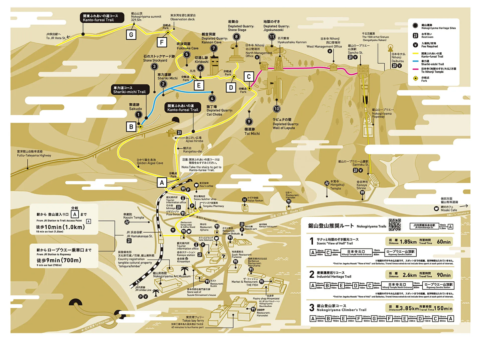
The map above shows the trail network around Mt. Nokogiri. For this course, we will follow the Nokogiriyama Climber’s Trail. Hikers starting from JR Hamakanaya Station, or the nearby Tokyo Bay Ferry terminal, can follow the yellow line on the map from the station. After about one kilometer you will reach a fork in the road (point A on the map) where we recommend turning left toward the start of the Shariki-michi Trail, just 500 meters up the road (point B on the map). The trail is named after the shariki laborers who once used this route to bring large stone blocks down the mountain in wooden carts. The slabs of rock excavated from Mt. Nokogiri, known as boshu ishi, were used in major construction projects around Tokyo Bay, especially during Japan’s modernization in the Meiji (1868-1912) and Taisho (1912-1926) periods.
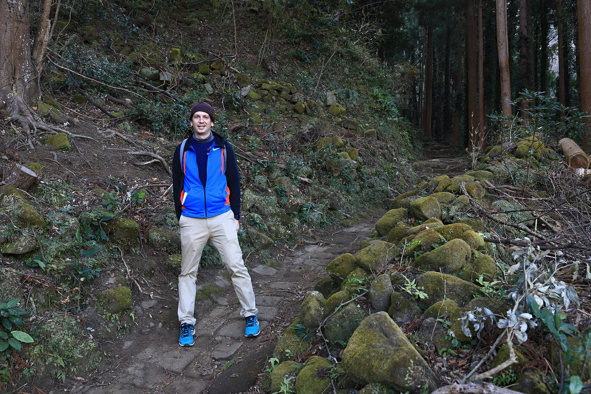
The shariki laborers were mostly women, and usually made the round-trip journey up and down the mountain three times a day. They would carry the carts up the mountain on their backs, then load them up with three slabs of stone, each weighing eighty kilograms. The Shariki-michi Trail that exists today is the product of these fully-loaded carts carving a path down the mountain. Eventually rail tracks, chutes, and pulley systems were installed here during the early twentieth century in order to bring the stone slabs down the mountain in a more efficient manner. Remnants of these installations can also be seen along the paths leading up the mountain.
The Shariki-michi Trail ends once it intersects with the Kanto-fureai Trail (point E on the map), a nearly 1,800-kilometer-long network of trails that wends through Tokyo and six prefectures in Japan’s Kanto region. At this intersection, turn left and walk 200 meters to the Tokyo Bay observation deck (point F on the map), and then the summit of Mt. Nokogiri another 500 meters from there (point G on the map). Once you’ve reached the summit, turn back toward the way you came and backtrack 700 meters to point E. From there, continue going straight along the Kanto-fureai Trail towards points D and C on the map.
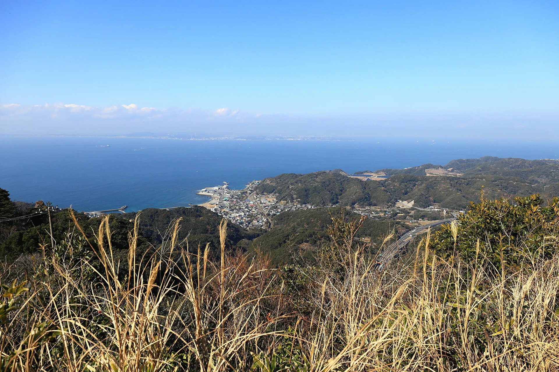 The view from the Tokyo Bay Observation Deck
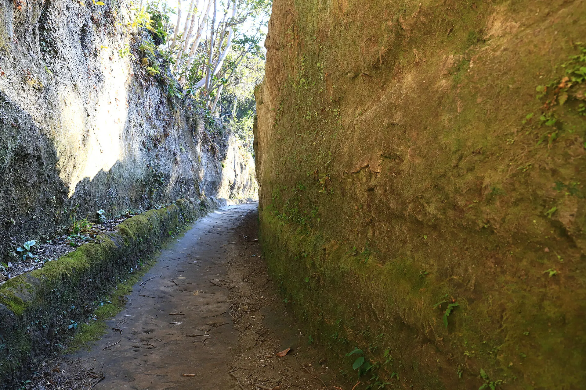
It is here along this next stretch of trail that the most impressive remains of Mt. Nokogiri’s history as a quarry can be explored: its manmade sheer vertical cliffs. Excavators first started by cutting the stone at the top of the mountain. However, the mountain is comprised of geological layers which run diagonally through its interior, meaning that in order to access the most sought-after stone, workers had to cut deeper into the mountain by digging caves. Skilled workers cut the upper portions of caves vertically, allowing for them to be cut in rectangular patterns from the top-down. This process was repeated as the excavation continued its way down the mountain, leaving the vertical cliff faces you see today.
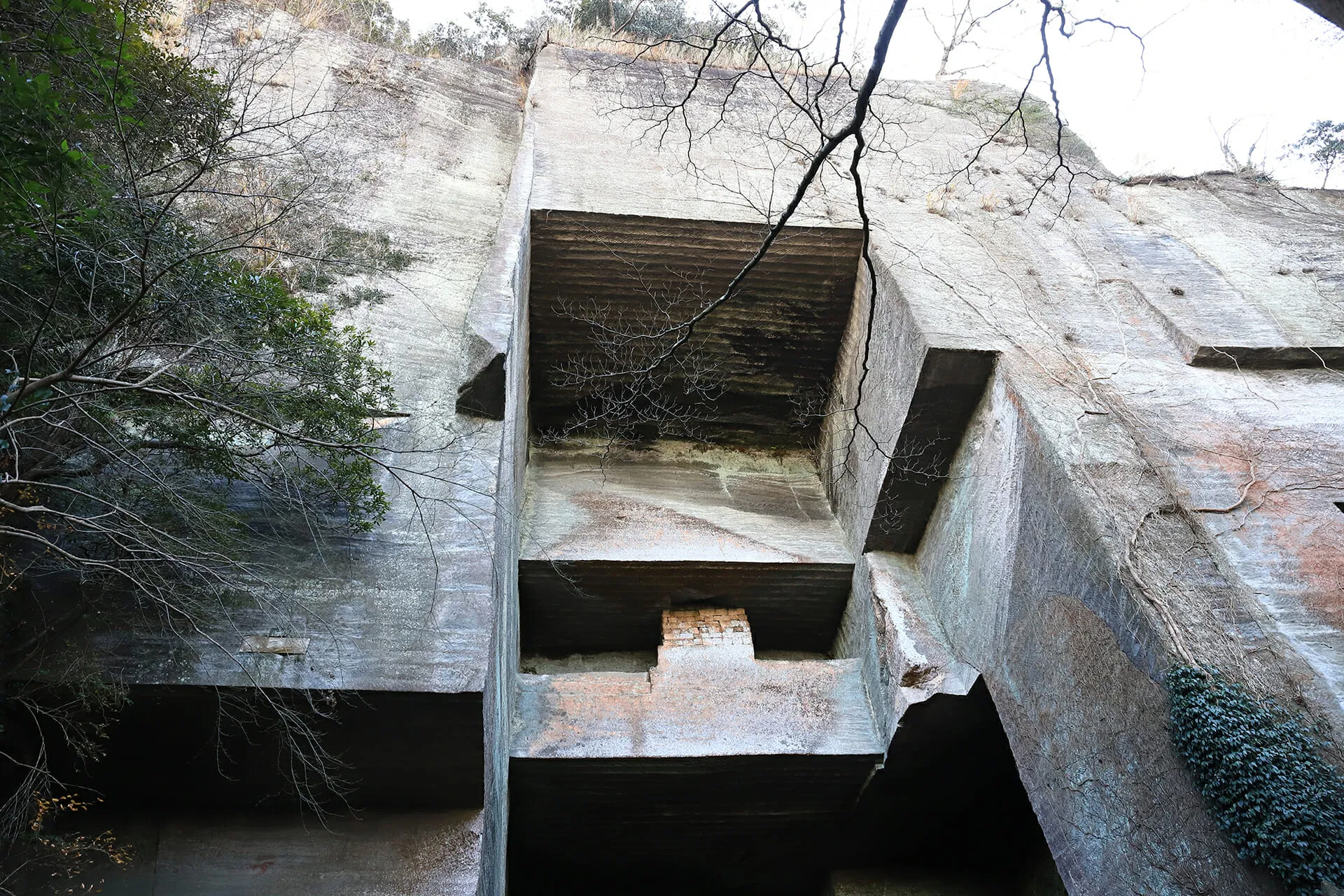 Looking up at the "Kannon Cave"
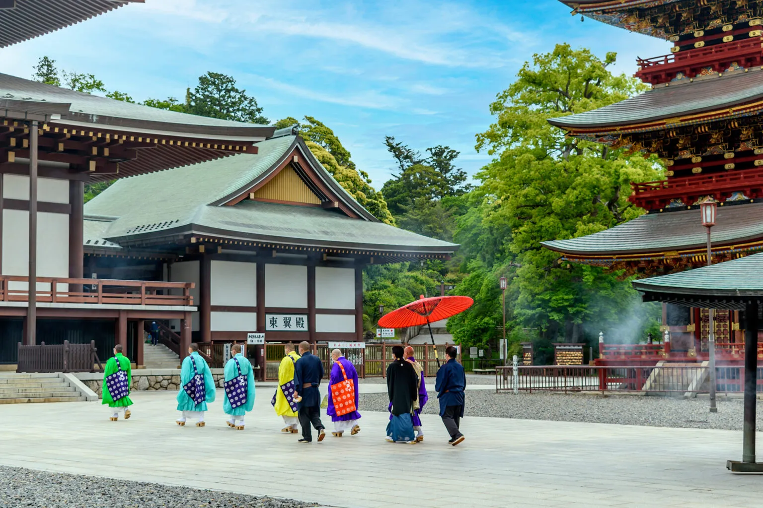
Follow the Kanto-fureai Trail until you reach the intersection (point C on the map) with the path that’s headed for the Nihon-ji Temple grounds. Hang a left here and continue on this route for 200 meters until you reach the temple’s northern entrance gate. From here you can explore the historic sites of the temple and take in sweeping views of the southern Chiba coast.
To learn more about ropeway access and the sites found on the Nihon-ji Temple grounds, like the famous “peek into hell,” Hyaku-shaku Kannon monument, and Stone Buddha ‘Daibutsu’ statue, click the button below:
The ropeway is scheduled to shut down for annual maintenance from January 13, 2026 through February 13, 2026.
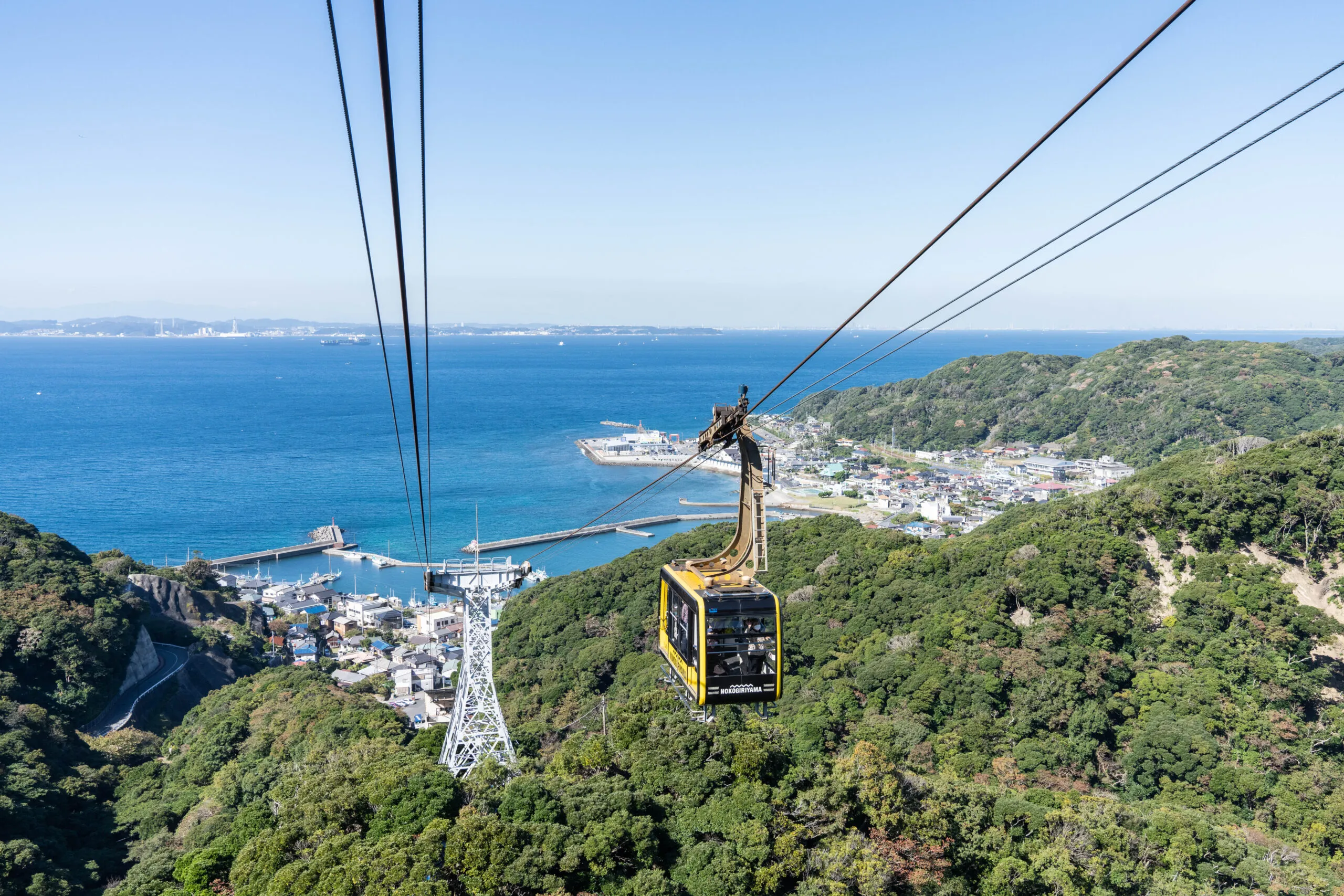 Mt. Nokogiri Ropeway
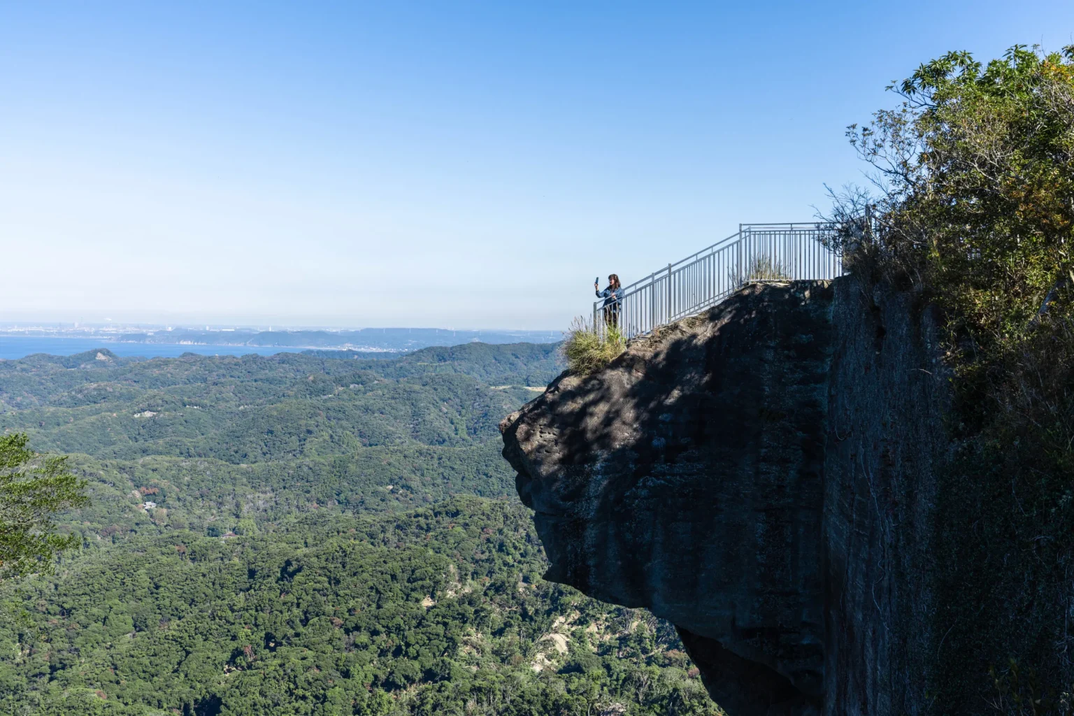
 Jigoku Nozoki "peek into hell"
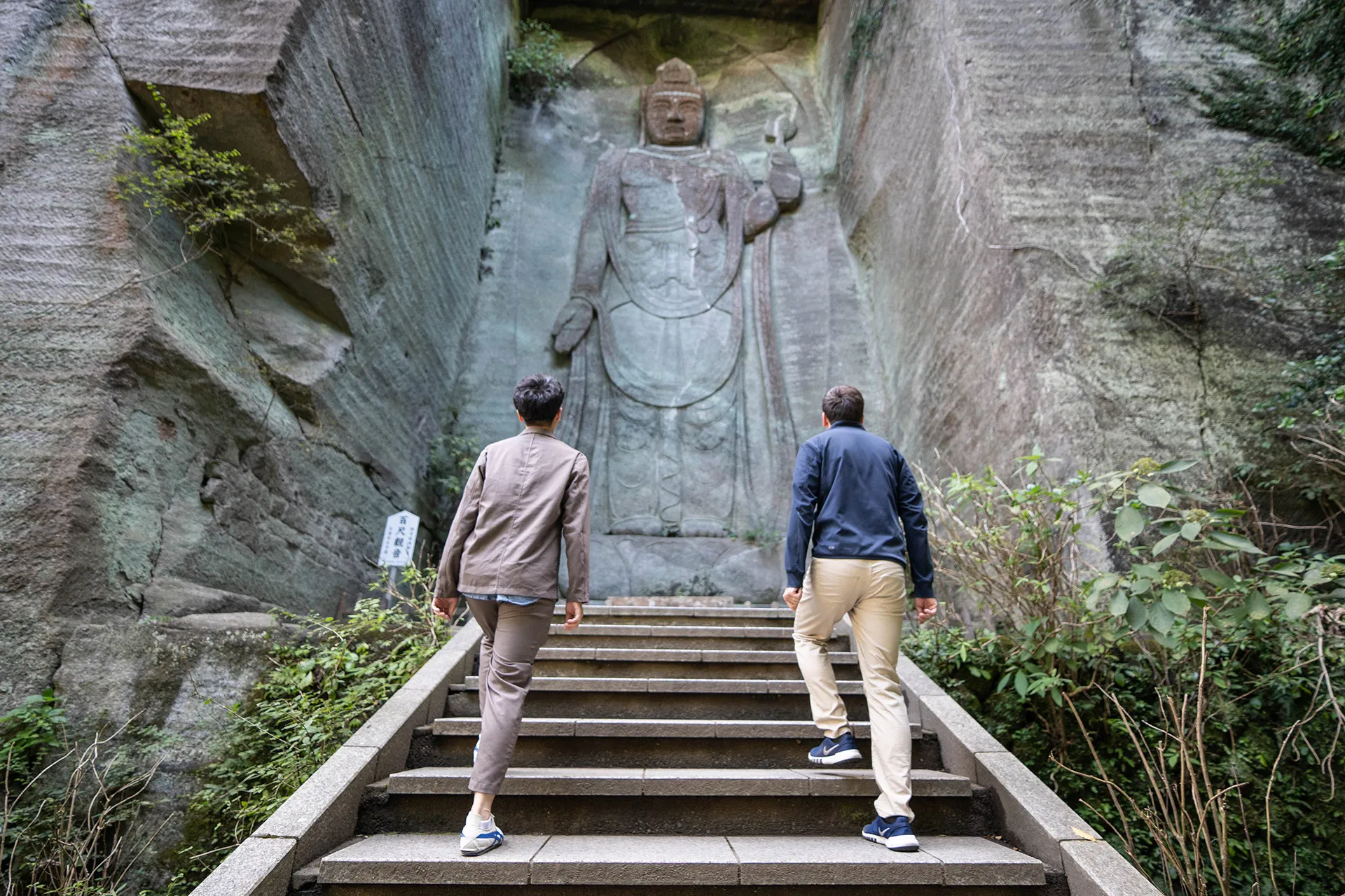 Hyaku-shaku Kannon monument
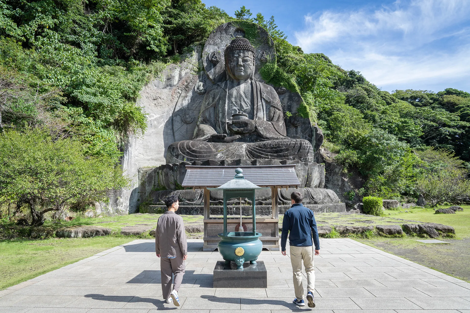 Stone Buddha 'Daibutsu' statue
Once you’re done exploring the sites atop the mountain, return to the Kanto-fureai Trail (point C on the map) and turn left to complete the last leg of the journey. The appearance of Mt. Nokogiri today tells a story of how human endeavors from the past can leave a mark – in this case literally carved into stone – that shapes the present and endures into the future. As you descend down this last stretch of trail and enjoy some final views of the mountain, take a moment to appreciate that your own endeavor is now part of this history too.
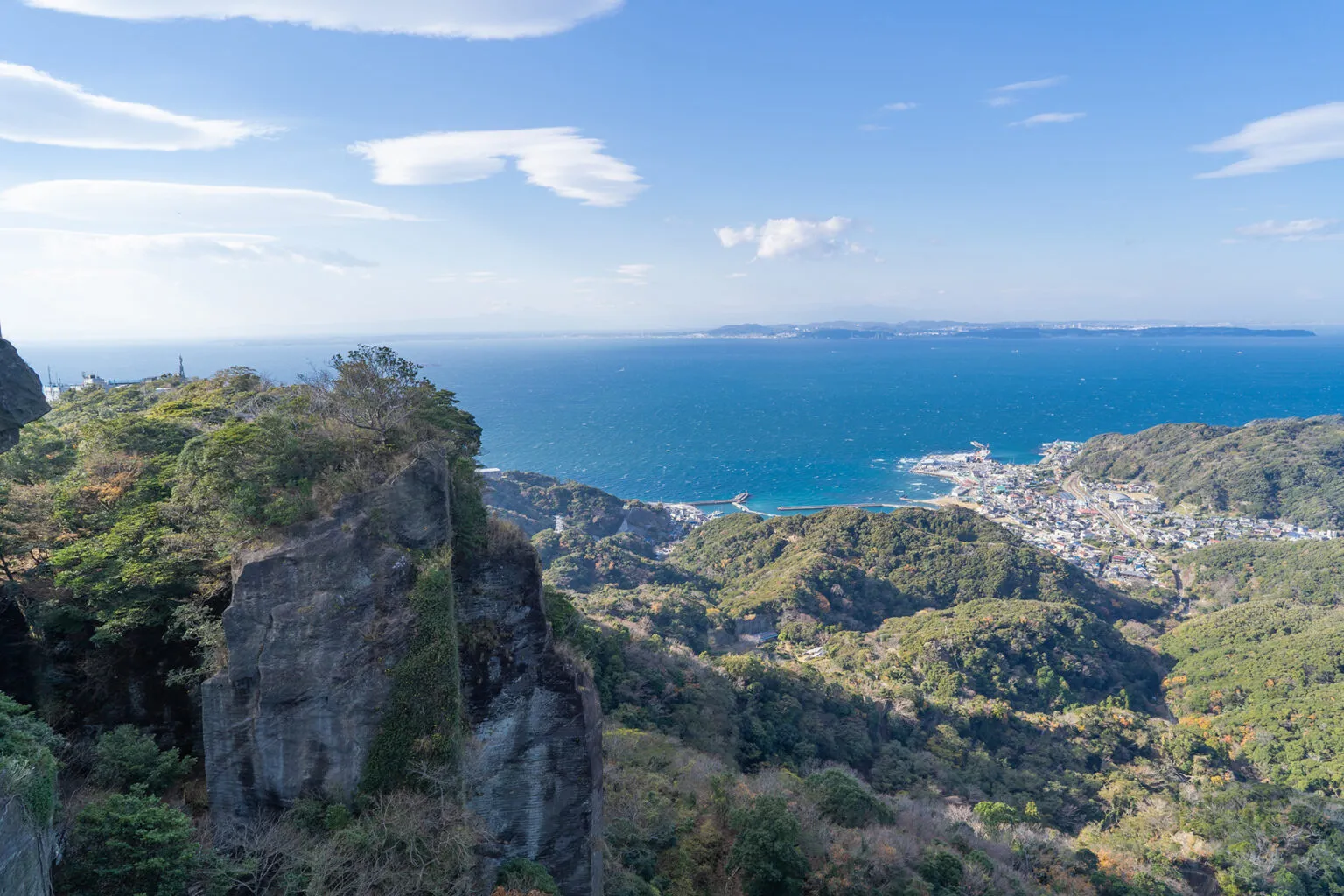
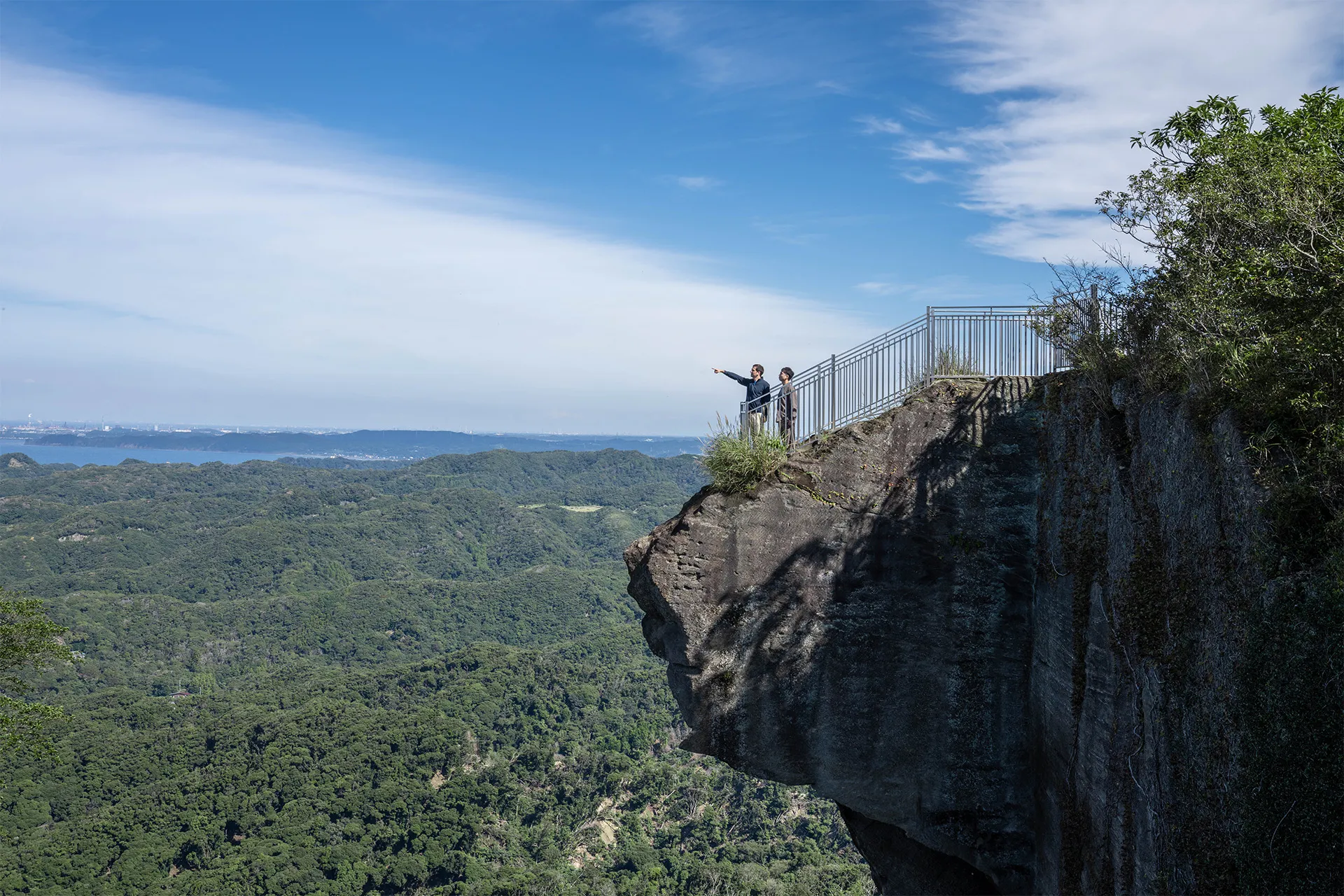
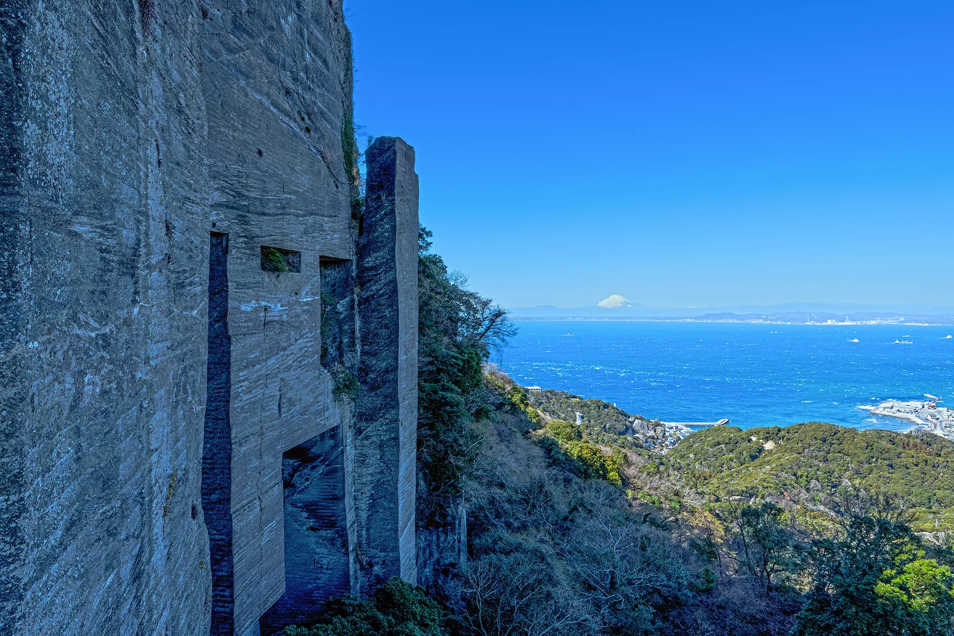 The "Wall of Laputa" with Mt. Fuji on the horizon
Nokogiriyama, Kyonanmachi, Awagun
(Mt. Nokogiri Ropeway: About a 10-minute walk from Hamakanaya Station on the JR Uchibo Line or the Tokyo Bay Ferry Terminal at Kanaya Port.)
+81-439-69-2314 (Mt. Nokogiri Ropeway)
Accessibility